
about image surveys LIMITED
Expert drone services across the North West & North Wales for farming, heritage work, property management and professionals
Call Now: 0800 999 1295
drone services you can trust
Professional service, Accountable results & Responsive to our clients
If you are responsible for a building, a site or a stretch of land, sooner or later you need to know its condition — the roof you can’t safely climb, the heritage façade you can’t touch, the field you can’t see all at once, or the storm damage you need assessed before anyone goes near it.
That's the kind of problem we are here to solve.
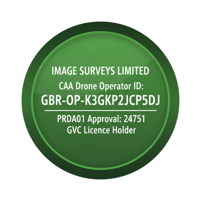
Image Surveys is a CAA-licensed, fully insured drone survey business based in Southport, working across Merseyside, Lancashire, Cheshire and the wider North of England. We turn places that are difficult, dangerous or expensive to reach into accurate, clearly reported data you can act on — usually faster and at a fraction of the cost of scaffolding or traditional access.
We work with property and facilities managers, housing associations, heritage and conservation professionals, landowners, developers, insurers and environmental consultants — people who are accountable for an asset and can’t afford to get the information wrong.
we work with your trusted professionals
Aerial data is only as valuable as the decisions it informs. We are expert drone operators but sometimes that is only a method to gather data for other experts to interpret and provide advice upon.
Our survey work doesn't sit in isolation — we work hand in glove with a network of independent, professionally qualified agronomists, professional valuers and surveyors.
The imagery and datasets we capture are designed to feed directly into their established workflows, so you receive not just high-quality aerial data, but data that experienced professionals can interpret, validate and act on.
For agricultural clients, this means our high-resolution and multispectral surveys are reviewed alongside qualified agronomic advice — turning NDVI maps, crop-health indices and field anomalies into practical, in-season decisions rather than raw imagery you're left to make sense of alone.
For heritage, estate and land clients, our outputs are produced to the standards expected by chartered surveyors and valuers: accurate, defensible records suitable for valuation, condition assessment, planning and conservation purposes.
Every flight is carried out under our full CAA Operational Authorisation, with comprehensive insurance and current qualifications in place — giving you, and the professionals we work with, complete confidence in the provenance and quality of the data.
Why clients choose to use us?
Anyone can buy a drone. What you are really paying for is the judgement, the licensing and the accountability behind the flight — and a result you can rely on.
• CAA-licensed — every flight is legal, planned and flown by a qualified commercial pilot.
• Fully insured — public liability and professional indemnity cover on every project, so your organisation is never exposed.
• Google 5-star rated — trusted by heritage professionals, developers, landowners and public-sector bodies across the North West.
• Local expertise — we know the region, its buildings and its planning environment, which matters for flight planning and permissions.
• Fast and responsive — most jobs deploy within days, and we offer genuine 24/7 emergency callout for fire, flood and storm damage.
• Reporting you can act on — you get data and imagery in formats you can use and defend straight away, not a folder of raw photos.
• Transparent pricing — a fixed written quote before any work begins. No surprises.
what people say
" It gave us detailed information on the work we needed to complete, it was cost effective compared to the alternatives and we were able to form a robust plan."
"Mark took time to work out what we needed , added value by raising issues we were not aware of and delivered on budget on time working safely and professionally."
How working with us works for you
We like clients to know exactly what to expect, so there are no surprises on either side. Here is the process from first call to final report.
1. Talk to us - let us find out what you are trying to achieve
Call or email and tell us what you need. We’ll give honest advice on whether a drone survey is the right tool and, where we can, a written fixed-price quote with a full breakdown.
2. We will handle the flight planning and permissions required
Once you’re happy to proceed, we take care of all pre-flight planning and safety checks. UK airspace has restrictions, and some locations need additional permissions or fees — we’ll advise you in every case and deal with the paperwork for you.
3.We will keep an eye on the weather conditions as the flight day approaches
Drones don’t fly safely in strong wind or rain, so once a date is set we keep a close eye on conditions. If the weather turns we may need to postpone — and we’ll always keep you informed rather than leave you guessing.
4.The day of the flight
We prepare and check our equipment, inspect the site and complete full safety checks before take-off and again on landing. Our pilot always has the final say on whether it’s safe to fly — a professional standard we never compromise, whatever the pressure to get the job done.
5. Your report
After the flight we process the data and deliver it to the timeline we agreed during planning — clear, accurate and ready to use. Once the work is paid for in full, the data is yours to use however you wish.
Our service promise
Our promise to you is to:
- help reduce your safety risk
- help save your time & money
- help you gain asset intelligence quickly
- Give you access to Emergency callout services
- deal with all safety & legal aspects of the flights for you
- offer a quick turnaround of work
- provide you with reliable accurate data
- provide outputs that support your plans
- provide access to AI systems for faster decision making
- work with minimum disruption to your business
Honest Pricing from £199*
Almost every job we do is bespoke. Because permissions and access depend heavily on location, no two surveys are quite the same — so wherever possible we give you a written, fixed quote up front, with a full breakdown. You should never have to make a decision without knowing the price.
We’re honest about where we sit. We are not the cheapest — there is always someone who’ll quote less through inexperience or by cutting corners. We’re not the most expensive either. What we offer is value: the right qualifications and licences, clear communication, a real understanding of your job, and a result you can rely on.
Want a price before you commit? Of course you do. Call or email in confidence and we’ll give you everything you need to make a decision.
“Our £199 starting price is based on a half-day on-site commercial roof inspection and report for a light industrial unit within 25 miles of our Southport office, in an unrestricted flight zone, excluding VAT.”
Regular and contract work
Many clients need ongoing reporting — monthly progress updates, or quarterly and annual inspections across a portfolio. We offer contract arrangements, and depending on frequency and length we can discount our one-off rates. Just ask when you first get in touch.
Our payment terms
As a small business, healthy cashflow matters to us — so we keep our terms simple and fair:
• New clients: payment within 7–14 days of invoice. After three completed jobs, standard 28-day terms apply, subject to credit checks.
• Invoicing: usually invoiced on completion. For larger projects we can often agree stage payments, which tends to suit both sides.
• Deposits: not always required, but where we have upfront costs — such as accommodation or licence fees payable to local authorities — we may ask for one. We’ll always discuss any fees with you in advance, so nothing comes as a surprise. We can also arrange stage payments for longer projects.
Full terms are set out in our standard contract, available to download below. If our terms are ever difficult for your organisation, tell us early and we’ll do our best to find a way that works for everyone.
Meet the director - Mark Carr
Mark established Image Surveys in 2023 after working successfully in several other areas and is now a fully qualified GVC-licensed commercial drone pilot, operating a fleet of drones and bringing the same exacting standards to aerial work that he has always applied on the ground. Additional certifications in environmental survey work and estate management applications mean he offers far more than striking aerial photographs — he delivers data-rich, professionally interpreted surveys, inspections and maps for property, land management, environmental and heritage clients.
Whether the task is a building inspection or an accurate aerial land map, Mark brings a rare combination of professional discipline, creative eye, pragmatism and technical expertise to every project — and the heritage sensibility to understand exactly why the result matters to the client.